
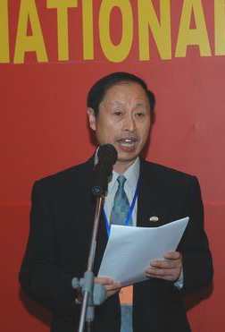
国际泥沙研究培训中心谭颖教授作大会学术总结
BRIEF OVERVIEW AND RECOMMENDATIONS
9th ISRS
TAN, Ying (IRTCES)
 The 9th ISRS
held in Yichang, China on 18-21 October 2004 was organized by the
Ministry of Water Resources, the P.R. China. More than 350 researchers
and engineers from 39 countries and regions are attending the symposium.
Representatives from UNESCO, IAHS and IAHR are at the symposium. The
symposium published comprehensive proceedings and provided opportunities
for extensive exchanges on the personal level. The World Association for
Sedimentation and Erosion Research (WASER) announced its establishment
during the symposium. The 9th ISRS, therefore, was a very successful and
significant event.
The 9th ISRS
held in Yichang, China on 18-21 October 2004 was organized by the
Ministry of Water Resources, the P.R. China. More than 350 researchers
and engineers from 39 countries and regions are attending the symposium.
Representatives from UNESCO, IAHS and IAHR are at the symposium. The
symposium published comprehensive proceedings and provided opportunities
for extensive exchanges on the personal level. The World Association for
Sedimentation and Erosion Research (WASER) announced its establishment
during the symposium. The 9th ISRS, therefore, was a very successful and
significant event.
The central theme of the symposium is “Interactions between Fluvial Systems and Hydraulic Projects and Pertinent Environmental Impacts”. More than five hundred papers have been received under this theme. After being reviewed, three hundred and ninty papers, including keynote lectures and invited papers, were printed in the voluminous Proceedings, covering six topics: (1) Large-scaled hydraulic projects and their impacts; (2) River sedimentation; (3) Estuarine and coastal engineering; (4) Environmental problems in sedimentation; (5) Soil and water; and (6) Sediment information.
Twelve keynote lectures were delivered at the plenary sessions by Suo Lisheng, Takeuchi, Sam Wang, Li Guouying, van Rijn, Ranga Raju, Liu Zhen, Walling, Zhang Ren, Hartmann, Wang Zhaoyin and Lu Jinyou. One hundred and eighty papers were presented orally at the technical sessions. Three special sessions were organized, namely, sediment problems in hydraulic engineering, observation and measuring technique of river sedimentation, and simulation technique on river sedimentation. There were also seven poster paper presentations.
The lectures, presentations and discussions covered a very wide range of objectives related to river sedimentation, such as hydroprojects and their impacts on fluvial processes and ecological system in rivers, flood control and river training, reservoir sedimentation and its management, headworks and desilting chambers, harbours and waterways, bridge and bed scour, sediment abrasion and energy dissipation, estuarine and coastal processes, debris flows and landslides, sediment biochemical processes and sediment quality, surface erosion and sediment yield, erosion control and watershed management, GIS and RS application, climate change and its impact, hydraulics and fluvial dynamics, physical and mathematical modeling, erosion and sediment measurement, and modern information technique, etc. A rich mixture of theory and practice was provided with a number of notable case studies on some projects and rivers from five continents, including, for example, the Three Gorges Project (TGP) and Yangtze River, and the Xiaolangdi Reservoir and Yellow River in Asia, the Aswan High Dam and Nile River, and the Lake Victoria in Africa, the Mississippi River in North America, The Belo Monte Reservoir and Xingu River in South America, the Rhine and Danube rivers in Europe, Eprapah Creek in Oceanica and others. All the lectures and contributions are highly appreciated for their advancement and good quality. From the presentations and discussions the following general conclusions emerged:
Rivers provide many essentials for human beings. River management is
of utmost importance for the well being of mankind. The objective of
river management is to establish harmonious coexistence between humans
and nature, with a special emphasis on preserving and improving the
eco-environment in river basins. As said for the Yellow River, we should
“ keep the rivers healthy”.
Sediment production, transport, deposition and its temporal and spatial
balance make a major impact on global landscapes as well as on the
circulation of water and nutrients. Especially, a river always
frequently adjusts its regime, cross-section, longitudinal profile, flow
course and pattern through the processes of sediment transport,
degradation and aggradation under natural conditions or artificial
control. Therefore, sediment management constitutes a key component of
river and land resources management.
Study and management of sediment should be directed to the entire
process of sediment movement from soil erosion to transport in flow,
including scour, deposition and redistribution. It covers the whole
river environment including catchment area, river channel, flood plains,
adjacent high lands, deltaic area etc. For instance, the sediment
research for the TGP has extended from 1000 km upstream to 1000 km
downstream, covering over 1 million km2 of area.
Conservation of soil and water aims at improving the ecological
environment and reducing soil erosion and sediment yield. An effective
approach for conservation of soil and water is comprehensive watershed
management based on the participation of indigenous people. The accuracy
of quantitative assessment on soil erosion is to be upgraded. In
addition to the traditional method based on measurement in typical
runoff areas and Universal Soil Loss Equation (USLE), radionuclide
tracers and remote sensing provide advanced tools for this.
Hydroprojects built on rivers and estuaries are usually designed for
flood control, power generation, water supply, navigation improvement,
reclamation and others. Nearly always, however, they impose drastic
changes in hydrological and sedimentary processes in rivers and affect
their up- and downstream environment, giving rise to some negative
effects. An optimal sediment design and management should employ a
“building with nature” approach and strive to investigate a tradeoff
and establish balances between benefits and harms, and, if possible,
minimize the negative effects.
Natural fluvial processes and the morphological changes induced by
hydroprojects have been studied for a long time. Considerable headway
has been made, although there are still many problems remaining to be
researched. Comparatively, however, the study on sediment quality and
ecological and biochemical issues caused by large-scale human activities
is just at the initial stage. In addition, the study of economic, social
and legal aspects of sediment problems is also insufficient. There is a
conspicuous scarcity of papers in these fields in the symposium.
Numerical simulation, physical modeling, analysis of field observation
and analogy with prototype data are effective tools for sediment study.
Because of uncertainty and complexity of sediment phenomena, these tools
may be combined to study some key problems. The correct understanding
and decision may be reached through mutual comparison between the
results from different approaches, although this involves higher cost
and longer time.
Mathematical models have been extensively and successfully applied to
studies on sediment yield, river sedimentation and morphological
processes since the 1970s. 1-D models are mainly used in assessing
long-term and averages in cross-section processes along long distance.
2-D and 3-D models are mainly used in studying local and detailed
phenomena near structures or in estuaries. The models can simulate the
more and more complex cases, such as non-equilibrium transport of
sediment with non-uniform composition, exchange between bed load and
suspended load, sediment movement in unsteady flow, etc. The accuracy
and reliability of a mathematical model in predicting sediment processes
depend to a large extent on the understanding of mechanism of sediment
transport, effectiveness of numerical solution methods, and calibration
against and verification by field and experimental data as well as the
user’s experience and art. There is, obviously, plenty of room for
improvement in these aspects.
A physical model is often used for studying detailed flow and sediment
movement in shorter reaches. Suspended load, bed load, and density
current; scour and deposition; and channel shifting, widening and
meandering etc may be simulated in a model with movable bed. The
similarity of a physical model mainly depends on selection of model
scales and model sand. In practice the application of physical models is
often constrained by available time, space and funds. In addition, the
boundary conditions of a physical model often need to be provided by
mathematical models and field observation.
Monitoring in situ and field data are essentials for upgrading theory
and models, discovering potential problems in time and improving
sediment management. New instruments and techniques have been employed
in sediment measurement. It seems, however, that recent development of
apparatus and technique for field measurement lags behind that of
calculation and post-processing. It can brook no delay to improve this
situation.
Recommendations for further studies:
Systematic studies on whole sediment processes in a basin from source to
estuary, establishing an integrated model including soil erosion,
sediment yield, sediment transport and distribution, as well as
morphological and ecological processes, in a river channel and estuary.
Investigating new approaches for sediment management in rivers,
reservoirs, lakes and estuaries, with more attention being given to
impacts of hydroprojects on ecological, economic, social and legal
aspects, and to mitigation of sediment hazards.
Paying close attention to global trends in soil erosion, land
degeneration and desertification, jointly carrying out a global
assessment of soil degradation and drawing up a new global map of
sediment yield, creating more effective approaches for soil and water
conservation.
In-depth understanding of the mechanisms of sediment movement in flow on
movable boundaries and upgrading the quality of physical relationships
on which the models are based, including especially rainstorm-induced
erosion, sediment-carrying capacity of flow under different water depths
and bed compositions, exchange between sediments in suspension and on
the bed with non-uniform particle compositions, role of cross-waves
around bends in affecting sediment transport and bed forms, uncertainty
of sediment transport, sediment movement in tide-water and friction
factors under oscillatory flows, mechanics of formation of flocs due to
chemical and biological actions and their movement, debris flows,
density currents, bank erosion, river regime theory ,etc.
Researching into ecological, biological and chemical processes caused by
sediment transport, and studying and improving remediation techniques of
contaminated sediments.
Studying and standardizing the method and procedure in calibration and
verification of mathematical models, and establishing a common database
of typical field data for the verification of models to promote the
advancement and dissemination of mathematical modeling.
Improving apparatus and facilities for field measurement of sediment,
standardizing sample processing and analytical procedures, and applying
modern techniques to sediment measurement, such as radioisotopic
fingerprinting, laser, radar, GPS, RS, GIS etc. to upgrade the
reliability, comparability and usefulness of field data.
Further sediment study and scientific and sustainable sediment management need close international cooperation and joint efforts of scientists, engineers and managers in relevant disciplines. Undoubtedly, the ISRS series and WASER just founded will play important roles in this field.
第九次河流泥沙国际学术讨论会是由中国水利部组织。来自39个国家和地区的350名学者和联合教科文组织、国际水文科学协会、国际水利工程学会的代表出席了会议。
内容丰富的论文集,广泛的学术交流,以及世界泥沙研究学会的成立,使本次会议具有重大意义,取得了巨大的成功。
会议的中心议题是“河流水利工程的相互作用及其影响”。
论文集收集了390篇文章,下分六个议题:
大型水利工程及其影响,
河流泥沙,
河口与海岸工程,
环境泥沙问题,
水与土壤,
泥沙信息。
大会请索丽生、Takeuchi、王书益、李国英、Van
Rijn、刘震、Ranga
Raju、Walling、张仁、Hartman、王兆印,卢金友作了主题报告。有180篇论文在分会报告交流,7篇论文张贴交流。会上还举办了三个专题报告会。
主题报告、论文报告和交流讨论涉及了广泛的领域,包括一系列来自五大洲的典型事例。论文水平高、质量好,从这些论文和讨论,我们可以得出以下认识:
1河流治理对人类的生存极其重要,河流治理的目标是建立人和自然的和谐共处。
2泥沙运动对全球环境和水与营养物的循环具有重要影响,泥沙治理是河流与土地治理的关键
3水土保持的目的在于改善生态环境与减少土壤侵蚀和河流输沙量。流域综合治理是水土保持的有效方法
4水利工程具有防洪、发电、供水、通航、围垦等效益,但它们改变了天然的水文泥沙过程,将引起一些副作用。泥沙治理应采用“适应自然”的方法,妥善处理效益与副作用的关系,尽量减少副作用。
5一般而言,人类活动引起的泥沙质量问题及其生态和生化作用的研究,目前还处在初始阶段。对泥沙导致的经济、社会和法律等方面的问题的研究,也还很不足。
7数值模拟、实体模型、原型观测及原型资料的分析与类比是泥沙研究
的有效手段。对实际中的一些重大问题,可将这些手段相互结合起来进行研究。
8数学模型能模拟越来越复杂的情况,其精度与可靠性主要取决于:泥沙运动基本理论的研究水平,数值方法,原型与试验资料的率定和验证,以及用户的经验和技巧。这几方面显然均需不断改进。
9实体模型的相似性主要取决于模型比尺和模型沙的选择。实体模型比较费时、费钱、和占用较大场地,此外还需数学模型与原型观测为其提供边界条件。
10现场监测与原型观测资料对改善理论和模型、发现实际问题和改进泥沙治理均极为重要。然而原型观测仪器和技术的改进近来似乎落后于计算和后处理。
对未来研究的建议
1对流域内泥沙运动全过程进行系统性研究,建立包括侵蚀、产沙、泥沙输移与分布、地貌与生态过程等的统一模型。
2开辟河流、水库、湖泊与河口治理的新途径,重视水利工程对生态、经济、社会、法律、防灾等方面的影响。
3密切注意全球土壤侵蚀、土地退化与沙漠化的趋势,共同进行全球地表侵蚀评价,绘制新的全球产沙图,摸索更有效的水土保持方法。
4深入研究泥沙运动基本理论,改进模型赖以建立的物理关系。
5重视泥沙引起的生态、生物与化学变化的研究,探索与改进被污染泥沙的修复技术。
6研究与规范数学模型率定与验证的方法和程序,建立典型原型资料的公共数据库,以促进数学模型的进步和广泛使用。
7改进原型观测的仪器与设备,统一和规范取样与分析程序,尽量应用现代先进技术,以提高原型资料的可靠性和实用性。
深入的泥沙研究与泥沙的可持续治理需要国际间紧密的合作,及科学家、工程师、管理者的共同努力。毫无疑问,在这方面河流泥沙国际学术讨论会与刚成立的世界泥沙研究学会将发挥重要作用。